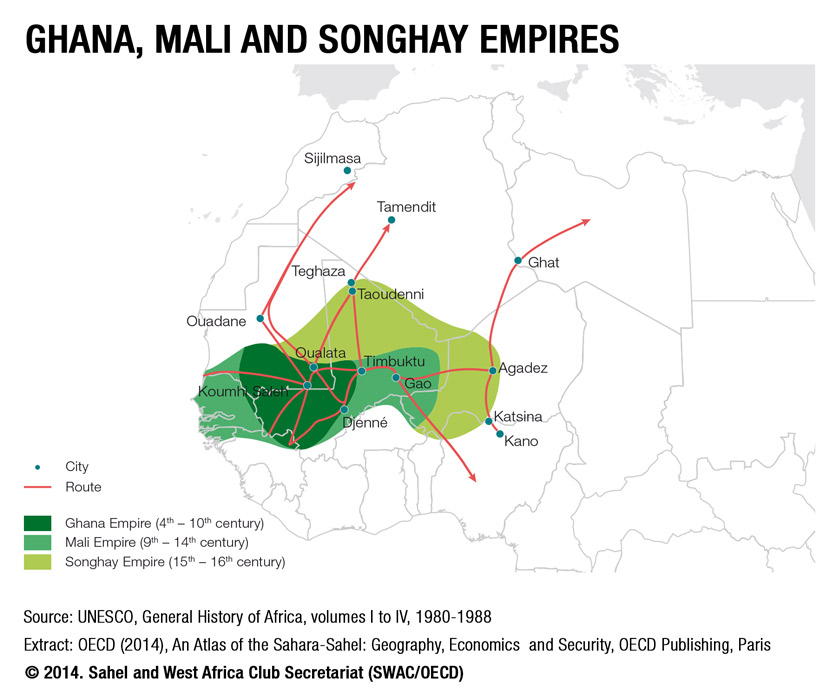
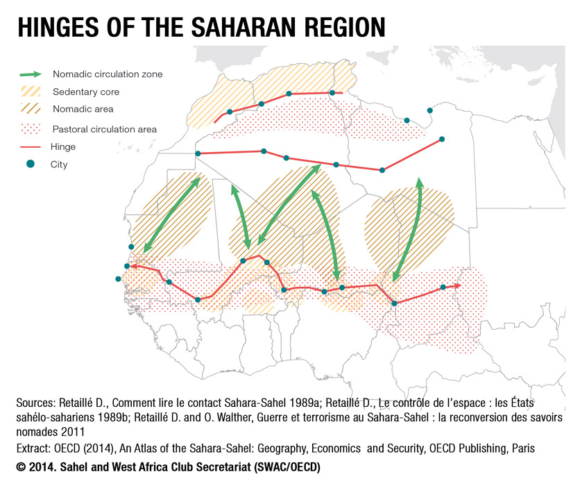
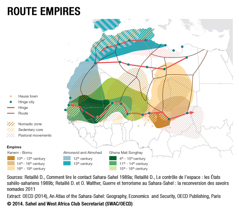
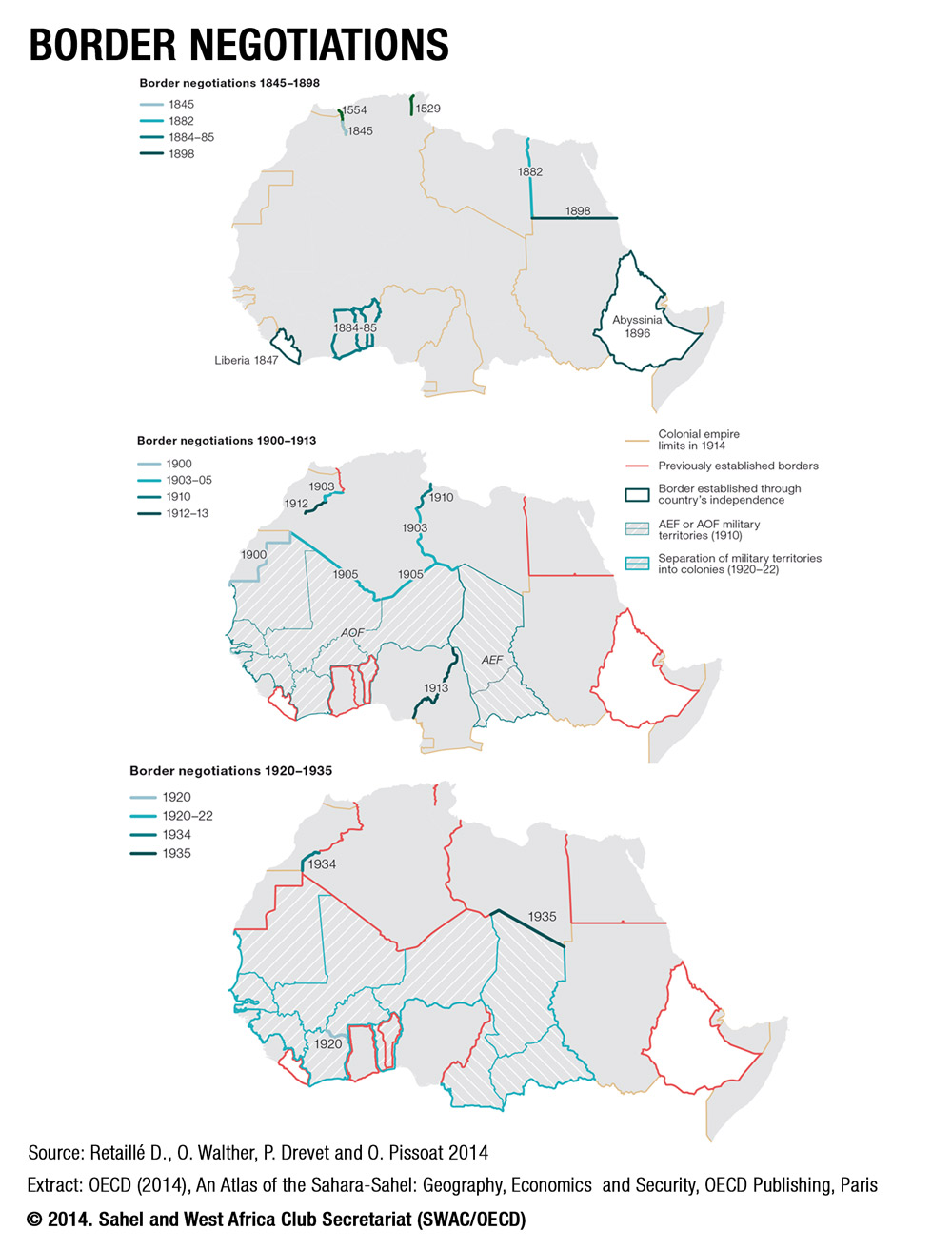
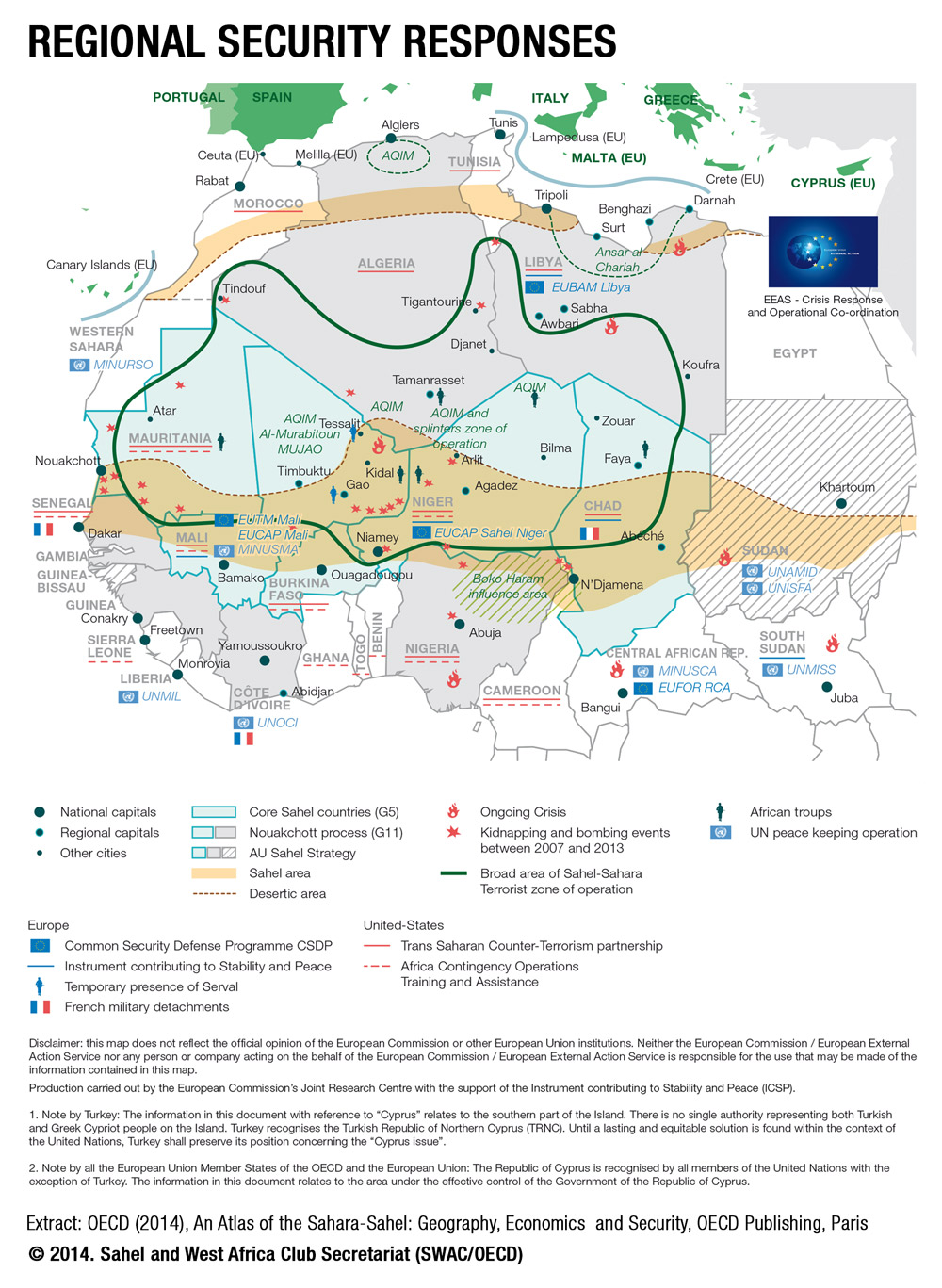
Maps - Atlas of the Sahara-Sahel
The following maps are extracted from the SWAC/OECD publication "An Atlas of the Sahara-Sahel: Geography, Economy and Security", December 2014.
You can copy and paste maps directly from the PowerPoint presentation (Part 1 | Part 2) or download individual maps by making a right click and choosing the option "save image as". You can also explore all SWAC maps in different formats (Web, HD, pdf) by key word, topic or country search on the SWAC Online Map Library.
![]()
![]()
![]()
![]()
![]()

![]()
![]()
Related Documents