Publications

Cross-border Co-operation and Policy Networks in West Africa
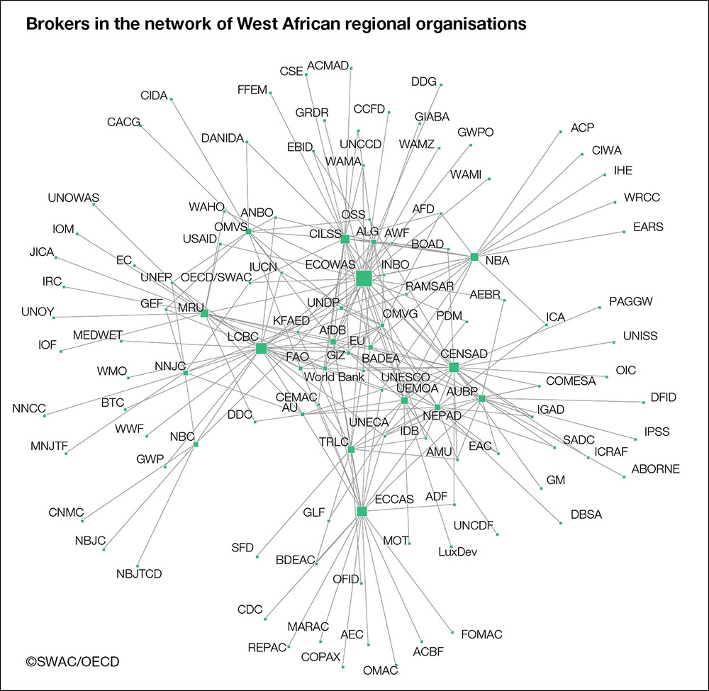
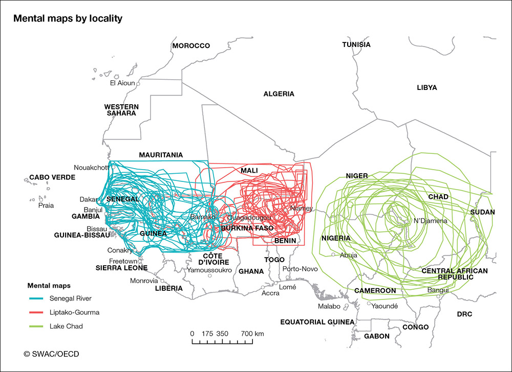
This publication examines how policy actors involved in cross-border co-operation
contribute to the regional integration process in West Africa. It uses a pioneering
methodology, known as social network analysis, to visualise the formal and informal
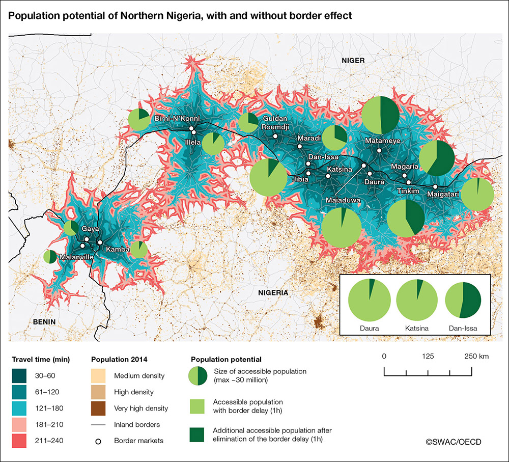
relationships between actors involved in cross-border policy networks, showing that
borders have notable and diverse impacts on exchanges of information and the relative
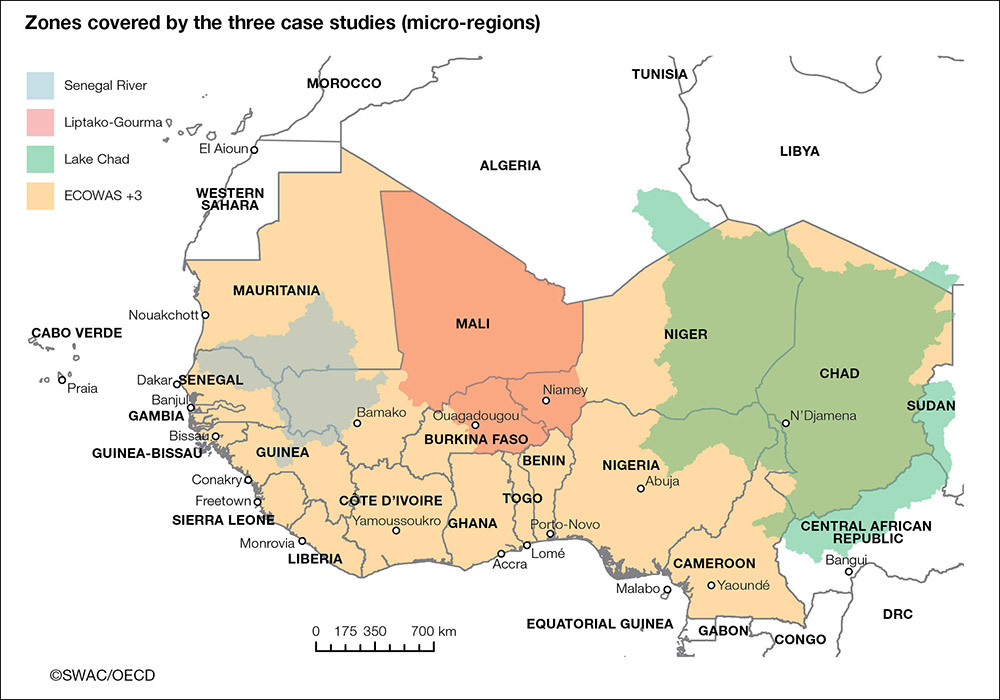
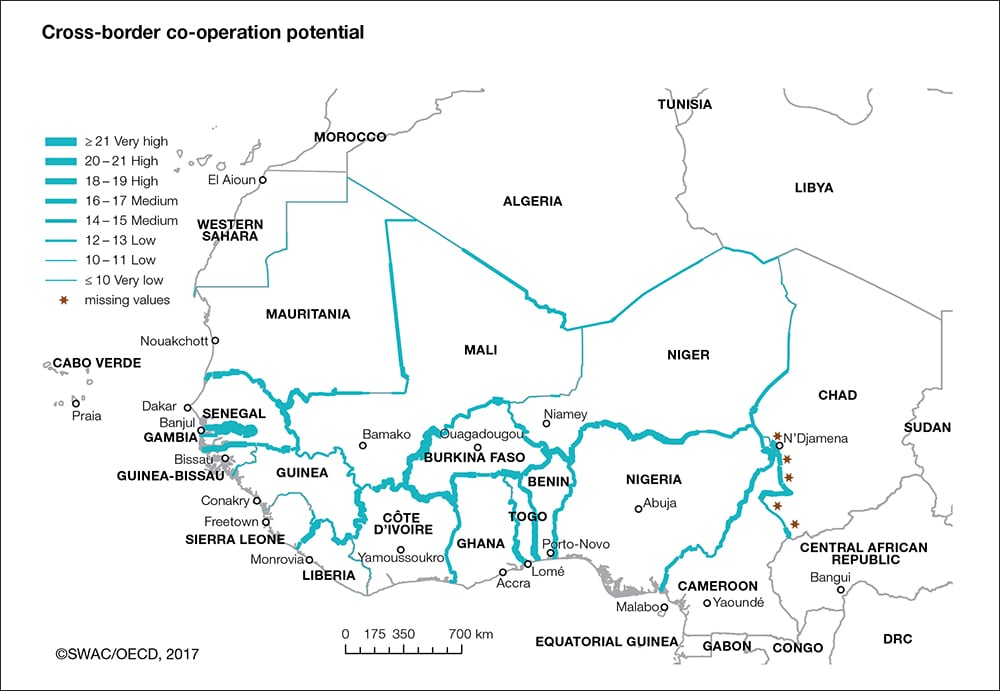
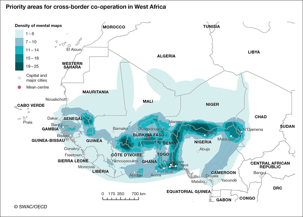
power of networks. The report then analyses a range of regional indicators of co-operation
potential, visually demonstrating that borders can also affect the ability of sub-regions
within West Africa to develop cross-border initiatives in a number of ways. Combining
these two analyses with the perceptions of regional policy makers as to which border
areas they consider as priorities for regional integration, the publication concludes
with the analytical foundations for more effective place-based policies that can enhance
cross-border co-operation in West Africa.
Published on January 13, 2017Also available in: French
In series:West African Studiesview more titles
TABLE OF CONTENTS
| The Club | |||||||||
| Preface | |||||||||
| Foreword and acknowledgements | |||||||||
| Abbreviations and acronyms | |||||||||
| Summary | |||||||||
|
Towards a new approach to cross-border co-operation4 chapters available
|
|||||||||
|
Cross-border co-operation: Potential, networks and political priorities4 chapters available
|
|||||||||
Powered by OECD iLibrary